Our 2nd day in Yellowstone was packed with stuff, and lots of photos, so this might be the longest post of the whole week's worth of vacationing. Pace yourself. :)
We started off with a delicious breakfast of pancakes, bacon, and eggs cooked on Jason's campstove. After breakfast, we made some sack lunches, packed up camp and headed on our way for a 2nd day of Yellowstone awesomeness. Our main goal for the day was to drive north on the lower loop and check out the Upper and Lower Falls along Yellowstone River, so we headed up that way.
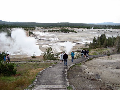
Serendipitously we found a variety of other fun things to check out along the way. On the map, we saw something called "Mud Volcano", and when we got there, we decided to stop and check it out. It actually turned out to be more than just the Mud Volcano, which was basically a lake of bubbling mud. In addition, there was also the Dragon's Mouth Spring, Sour Lake, the Churning Cauldron, and a couple other bubbling, smelly lakes. And let me just say that they were indeed smelly. Like rotten egg smelly. Really rotten. Kind of overpowering at times. Probably the coolest was the Dragon's Mouth Spring which was a cave where water came out in waves, and steam was constantly rising, and there was a constant stream of booming noises coming from the cave. I have to wonder what people thought about these things when they were first discovered, before there was a wooden walkway going up to it with signs and everything. Amazing stuff.
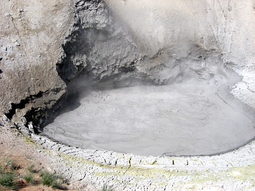
The Mud Volcano
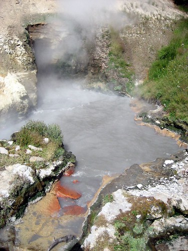
Dragon's Mouth Spring
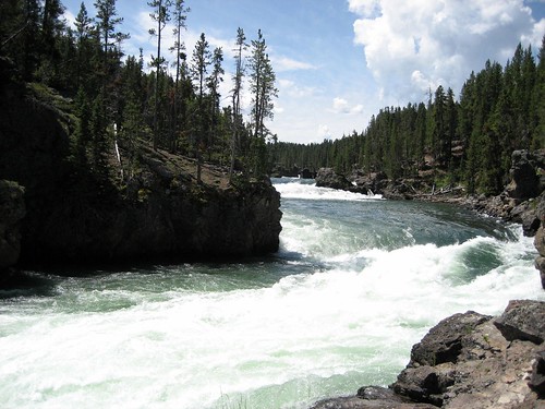
After walking around the Mud Volcano area, we crossed to road and walked down to the river to check that out. Nothing too noteworthy other than simply being very picturesque.
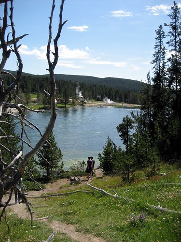
Yellowstone River
We got back on the road headed north, and as we entered the Hayden Valley, we had the chance to see a few more bison up close to the road. We pulled over to look at one of them a little closer.
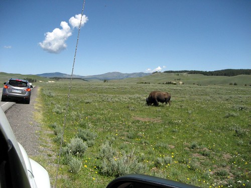
Pulling over to check out a buffalo
The funny thing is how excited we were about seeing a single buffalo, when waiting for us just around the bend was a gigantic herd of them. There were probably hundreds of buffalo in this valley. Maybe thousands, but of what we saw, I'm sure there were at least 100 head. A little further up the road, we reached a point where a large group was crossing the road, so as traffic was stopped we got a good look at them and were able to take some photos and video. One of the highlights of the trip for me.
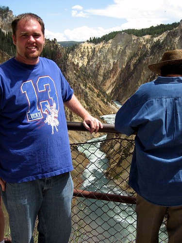
Moving on from our buffalo crossing experience, we finally were nearing the waterfalls we'd planned to check out. Our first stop was the brink of the upper falls, which was just a short walk down from a parking lot. One thing that I personally enjoyed about Yellowstone was how accessible many of the things were. I understand that it might be more enjoyable without eighty other people there, but especially this day, I was struck by how much you could see in a single day without needing to hike 3 hours each way.
Looking upstream from the Upper Falls
After checking out the upper falls, Jason suggested we backtrack just a tad to a spot on the other side of the river where we could hike down and see the falls from below, called Uncle Tom's Point. It was just a quick drive over there, but unfortunately the trail down to the viewing spot was closed for repairs, so we had to settle for a view of the falls from across the river, but not down low like we'd hoped.
Looking back across at the Upper Falls. If you look close you can see people at the viewing platform.
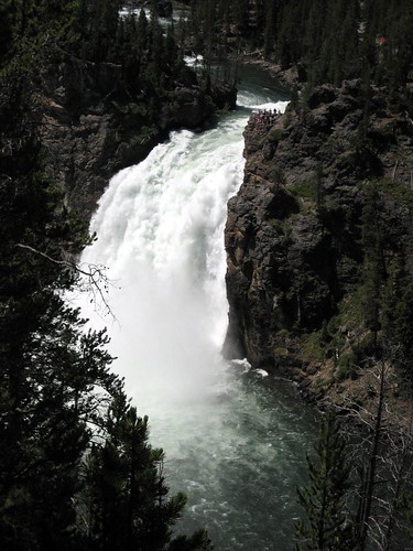
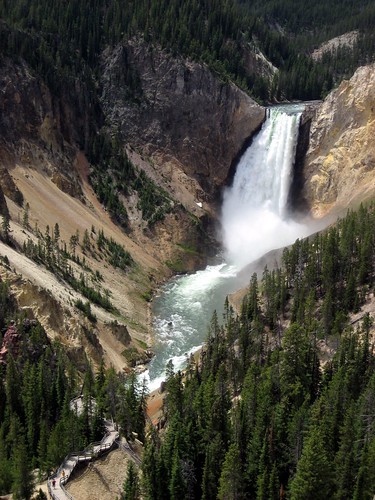
Then it was back across the bridge and further downstream in search of the lower falls. The hike down to the brink of the lower falls was quite a bit longer than the hike down to the brink of the upper falls, but still only 10 to 15 minutes (and of course a bit longer going back up those switchbacks). Along the way down, there was a look out spot to look down the canyon. I stopped to take a gander and was stunned by the beauty of the canyon. The colors of the canyon walls were just surreal (I realized after coming home that this must be why it's called Yellowstone), and the river running down the middle looked like a painting. Just gorgeous. There were better views further down, but this was my first glimpse and it really was awe-inspiring.
Looking down at the Grand Canyon of Yellowstone from the Lower Falls brink
More
See? I was there!
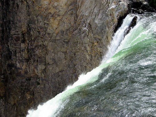
The actual falls themselves
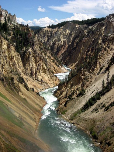
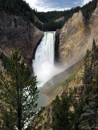
We took our time enjoying the view of the falls from above, and then made the hike back up to the parking lot. From there, we headed further downstream to another lookout spot to look back the lower falls. There was a nice view near the parking lot, but most of us also chose to take a longer hike down to the Red Rock viewing platform where the view of the falls was even better.
Looking back upstream at Lower Falls. Down below you can see the Red Rock viewing platform.
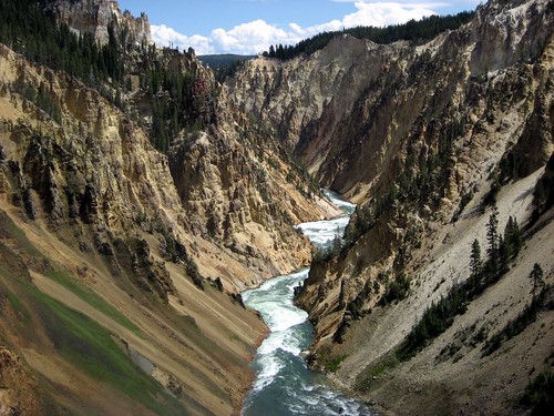
The view from Red Rock
After taking more photos down there, we made our way back up again, and regrouped at the cars to decide on our next step. We decided it was probably time for lunch and that we'd stop at the next picnic area we came to.
After a short drive, we found a picnic area where we relaxed and ate our lunch while planning our next move. We'd talked about going north and going around the northern loop and maybe seeing Tower Falls and Mammoth Hot Springs, but given that the weather was looking a little stormy, and that we'd already seen some very impressive waterfalls already, we decided to skip the northern loop and cut across the middle of the park, and head toward our campsite for the night.
First, though, we stopped at a visitors center near the intersection of the highways to see what it had to offer. Mostly I was happy to find that it offered a couch I could sit on for a bit. :)
After resting up a bit, and having a bit of rain, we hit the road again, heading west across the park toward Madison. Along our way, we stopped at the Norris Geyser basin, to see what non-Old Faithful geysers look like. The first thing we went to check out there was the Porcelain Basin. The view was quite extraordinary. Something scorched earth post-apocalyptic perhaps, or maybe just alien. We walked along the rim for a while, then headed back to where we'd started to go another direction and check out Steamboat Geyser.
Porcelain Basin
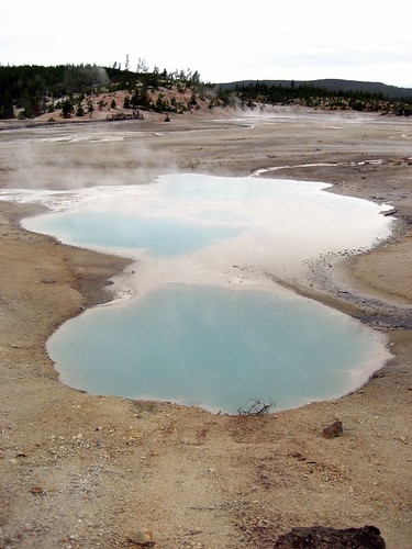
Porcelain Basin
Steamboat Geyser apparently has had some of the largest eruptions recorded in the park, but they are far from predictable, and the last big event occurred a long time ago (I forget whether it was 7 years or 50 years, or something else. Just that it wasn't something to hold your breath for.) Despite not being spectacularly impressive, there were minor spurts of water and steam every few minutes, and it was a nice supplement to the previous day's experience at Old Faithful. And perhaps made me appreciate both the regularity and magnitude of Old Faithful by comparison. I'm sure there are other possibilities along the Geyser spectrum, but those are the only two I've really seen so far. :)
Steamboat Geyser
After enjoying the Norris Geyser Basin, we hopped back in our vehicles and headed south for Madison. All weekend, we'd been seeing signs letting us know that there would be delays on this stretch of highway due to construction, but when we got to the construction, we only waited a minute or two. Then a few miles down the road, traffic bogged down again, and we figured it must be the rest of the construction. Not so. In fact, it was due to a small group of bison who decided to stop in the middle of the road and just hang out while cars slowly trickled past them on the other side of the highway.
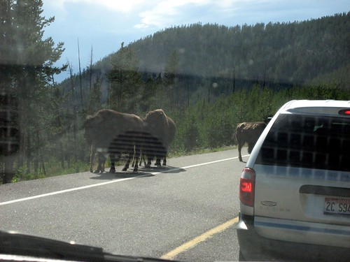
Bovine Road Block
After getting past this bovine roadblock, we quickly arrived at the Madison campground area. We set up camp and set about chopping some deadfall for firewood. The weather was still pretty overcast and a little rainy. Then a park ranger pulled up in his golf cart to inform us that a big storm -- "40 mph wind and an inch of rain" -- was an hour away. So we scrambled to make sure that all of our belongings were secured and covered, then hustled to get dinner ready (beef stew warmed up over the fire) before the storm hit. Then, the storm never actually materialized. Given my history of bad luck with camping weather, I told Kelly it must have been his good camping luck overpowering my bad camping luck.
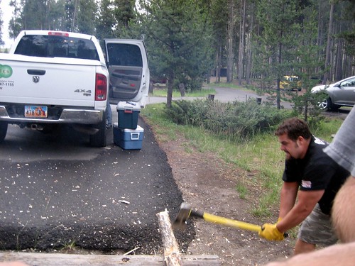
Kelly chopping some wood
Once it was clear that no storm was coming, we played some Phase 10, and then hung out around the fire until fairly late.
No comments:
Post a Comment